
Sort by:
Best match


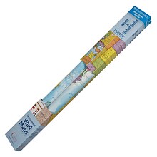
National Geographic Space, Stargazer folded Map Pack Bundle, Folded: 4.25" x 9.25" ; Flat: 25.25" x 18.5" (NGMRE01021309B)
Item #: 901-24611454
National Geographic's Stargazer Map and Guides Map Pack Bundle of Space includes maps that get progressively further from Earth on four waterproof tear-resistant maps.
Measures 4.25" x 9.25" folded and 25.25" x 18.5" flat
Each Stargazer Map and Guide shows detailed maps and graphics to help locate features on the moon, planets, and stars.
$43.59
Per set

National Geographic Antarctica Satellite Map, Laminated, 31.25" x 20.25" (NGMRE00620144)
Item #: 901-24611405
National Geographic Antarctica Satellite Wall Map has a striking view of Antarctica's terrain, compiled from 4,500 satellite scans
Additional inset maps show surface elevation, ice sheet thickness, velocity of ice flow, and sea ice movement and windflow.
The map is encapsulated in heavy-duty 1.6 mil laminate which makes the paper much more durable and resistant to the swelling and shrinking caused by changes in humidity.
$25.99
Per each


National Geographic Earth's Moon Map, Laminated, 42.5" x 28.5" (NGMRE00620137)
Item #: 901-24611437
National Geographic's "The Earth's Moon" is like having an atlas and almanac in one.
This incredibly informative wall map features detailed depictions of the entire surface of the moon with a selective index showing the named physical features.
Diagrams show the moon's orbital paths, rotation around Earth, librations, how solar and lunar eclipses occur, how the moon affects Earth's tides, and more.
$38.19
Per each


National Geographic World and United States Executive, Poster Size, Map Pack Bundle, 36" x 24" (NGMRE01021232B)
Item #: 901-24611443
National Geographic's World and United States maps are the standard by which all other reference maps are measured.
Measures 36" x 24"
Antique-style "executive" color palette
$30.99
Per set


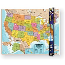
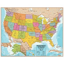
National Geographic United States Classic Map, Laminated, 43.5" x 30.5" (NGMRE00620411)
Item #: 901-24611428
National Geographic's United States wall map is the standard by which other reference maps of the U.S. are measured
Measures 43.5" x 30.5"
Signature Classic styling with bright, easy to read color palette with blue water and colorful state borders. All 50 states with insets for Hawaiian Islands and Alaska
$32.89
Per each
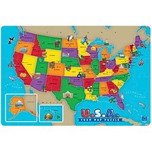
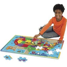
Educational Insights Foam Map Puzzles, USA
Item #: 901-JV37188
Age group and grade: Ages 5 - 7 and grades kindergarten+
Theme/design: Map
Material: Beech wood
$30.79
Per pack
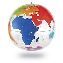

Learning Resources Inflatable Globe, Labeling
Item #: 901-JV35588
Age group and grade: Ages 5 - 8 and grades kindergarten+
Large 27" inflatable globe printed with only the continents and lines of latitude and longitude
Size: 27"(Dia)
$23.99
Per each


National Geographic The Milky Way Map, Laminated, 31.25" x 20.25" (NGMRE00620140)
Item #: 901-24611410
This computer-generated image of the Milky Way shows the entire galaxy in one perspective of a 3-D model compiled specially for National Geographic.
The model incorporates the positions of hundreds of thousands of stars and nebulae within the galaxy, shows Earth's location.
Includes additional photographs, descriptions and locations of fascinating phenomena throughout the Milky Way.
$33.69
Per each


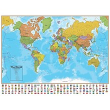
National Geographic World Satellite Map, Laminated, 43.5" x 30.5" (NGMRE00622011)
Item #: 901-24611314
National Geographic's striking satellite map of The World is a visually stunning image that makes a wonderful addition.
Measures 43.5" x 30.5"
The beauty and complexity of Earth's landscapes, both above and below the oceans, is revealed with the Global Satellite Mosaic.
$33.19
Per each


Waypoint Geographic World/USA Laminated Notebook Maps, 12/Pack (RWPNB02)
Item #: 901-24610186
Makes easy reference for continents, countries, states and major World and USA cities and other points of interest. Laminated
World on one side, USA on the other
Set includes 12 notebook maps measuring 8.5" x 11" and a 12 count clip strip
$75.39
Per pack


National Geographic Continental Divide Trail Map, In Gift Box, 18" x 48" (NGMRE01021204X)
Item #: 901-24611457
National Geographic Continental Divide Trail Wall Map- National Geographic's map of the Continental Divide Trail is ideal for fans and hikers of this magnificent National Scenic Trail.
Measures 18" x 48"
It makes a great planning tool or as reference to track progress on the 3,100 plus mile length.
$20.79
Per each

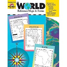
Evan-Moor® The World - Reference Maps & Forms
Item #: 901-JV37097
Age group and grade: Ages 3 - 18 and grades 3rd - 6th
Also includes evaluation forms, crossword puzzle, word search and answer key
Author: Jo Ellen Moore
$20.79
Per each


Featured


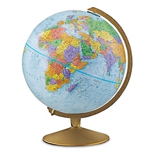
Replogle Globes The Explorer Political Raised Relief Classroom Globe, 12" (RE-30501)
Item #: 901-JV45264
Classroom World Globe
Size(s): 12" diameter
Material(s): Plastic
$83.79
Per each
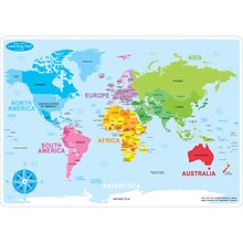
Ashley Productions Smart Poly™ Learning Mats, 12" x 17", Double-Sided, World Basic Map, Pack of 10 (ASH95602)
Item #: 901-24389567
Water Resistant
Colorful designs on both sides
Measures 12" x 17", pack of 10 learning mats
$57.29
Per pack
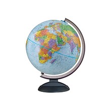
Replogle Traveler World Globe, 12"Dia (30513)
Item #: 901-JV38113
World globe is a great tool for high school and college students
Globe dimensions: 12"Dia, 16"H x 13"W x 12"D
Ball made of 100% reclaimed paper fiber in blue with smoke black plastic base
$72.19
Per each


Waypoint Geographic World/USA Laminated Notebook Maps, 32/Pack (RWPNB03)
Item #: 901-24610195
Makes easy reference for continents, countries, states and major World and USA cities and other points of interest. Laminated
World on one side, USA on the other
Set includes 32 notebook maps measuring 8.5" x 11"
$187.99
Per pack
Hemispheres Blue Ocean Series World & USA Laminated Wall Maps, 2-Pack (RWPHMB02PK)
Item #: 901-JV1112500
Classroom U.S.A & World Map
Size(s): 38" x 51" World, 38" x 48" USA
Material(s): Laminated Paper
$51.29
Per pack
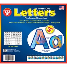
Hygloss Products 3" Punch-Out Letters, Globes (HYG10019)
Item #: 901-JV2127315
Letters/Decoration
Assorted Colors
10.5" x 9" x .5"
$14.89
Per pack
Hemispheres® United States Wall Chart with Interactive App, Laminated, 32" x 40.5" (RWPWC06)
Item #: 901-24519760
Colorful laminated wall map
Inactive with 100's of facts
Free app included
$31.79
Per each
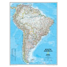
National Geographic Maps South America Wall Map, 24" x 30"
Item #: 901-JV158528
Subject: Social studies
Subject: Science/technology, nonfiction
Classic map of South America shows political boundaries, place-names, airports, major roads and highways, and other geographic features for the entire continent
$26.49
Per each
Popar 32" x 54" Kid's World Map Interactive Wall Chart with Free App (RWPWC04)
Item #: 901-24526317
Read-alongs and videos about the ancient world, modern world, and natural wonders
Measures 32" x 54"
Interactive with free app
$32.49
Per each


National Geographic World and United States Coloring, Map Pack Bundle, 36" x 24" (NGMRE01021221B)
Item #: 901-24611425
National Geographic's cartographers adapted our World and United States for Kids Maps to black and white outline versions that you can color.
Measures 36" x 24"
The World and United States Coloring Maps include country and state flags that can all be colored along with a bonus full color letter size sheets that has all of the flags.
$21.59
Per set


National Geographic Pacific Crest Trail Map, In Gift Box, 18" x 48" (NGMRE01020758X)
Item #: 901-24611433
Expertly researched and designed, National Geographic's map of the Pacific Crest Trail is ideal for fans and hikers of this magnificent National Scenic Trail.
Measures 18" x 48"
It makes a great planning tool or as reference to track progress on the 2,600 plus mile length.
$26.09
Per each


National Geographic The Solar System: 2-Sided Map, Laminated, 24.25" x 18.25" (NGMRE00620138)
Item #: 901-24611383
National Geographic's The Solar System, Our Sun's Family, has two sides.
The first side includes a description of how our solar system was formed, and shows a map of our solar system, with each planet's orbit in relation to the Sun and to the other planets.
Side two is a stunning poster that shows images of each planet.
$27.59
Per each

